Autel EVO Max 4N - 2025 年最佳夜视无人机
EVO Max 系列配备 720 度避障和 A-Mesh 1.0 网络支持,是下一代智能、敏捷的无人机。EVO Max 4N 代表了该系列的夜间行动就绪产品,配备了星光夜视、变焦和热像仪,以及完整的激光测距功能。 凭借其卓越的星光摄像头,该无人机可以在低至 0.0001 勒克斯的照明条件下运行,在黑暗中带来无与伦比的性能。 夜间调查、应急响应等 - EVO Max 4N 都可以实现。
混合传感器有效载荷
EVO Max 4N 有效载荷集成了广角、星光和热像仪以及激光测距仪,可满足所有数据采集需求和关键决策。
 星光相机
星光相机
凭借令人印象深刻的 0.0001 LUX 和 ISO 范围为 100-450,000,它能够在夜间锁定和跟踪目标。 这款相机是探索夜晚的终极工具。
激光测距仪
点击目标以从 0.75 英里外快速获取坐标和高度。
热像仪
配备 640x512 高分辨率辐射热像仪,30fps 和 16 倍数码变焦。
广角相机
Autel 的月光算法 2.0 增强了后期处理能力,使飞行员能够在弱光环境下捕捉清晰、细致的图像。
视频:支持 4K 30fps,最高 ISO 64000。
照片:月光模式可降低噪点并增强 HDR。
无人机智能领域的领导者
EVO Max 4N 配备了广泛的特性和功能,包括自主寻路、GPS 拒绝环境中的导航以及准确的物体识别和跟踪。
自主寻路
Autel 的自主引擎收集周围的环境数据,并在山脉、森林和建筑物等复杂环境中规划 3D 飞行路径。 用例包括快速 3D 场景重建、公共安全监视、工业检查和土地测量。
在
GPS 拒绝的环境中导航
先进的传感器使 EVO Max 4N 能够在硬化结构内、地下或没有 GPS 的环境中导航。
准确的物体识别和跟踪
EVO Max 4N 基于 Autel 的 AI 识别技术,可以自动识别和锁定热源、移动人员或车辆等不同类型的目标,实现执法人员的高空跟踪和数据采集。
无盲点
终极避障
EVO Max 4N 是唯一一款将传统双目视觉系统与毫米波雷达技术相结合的商用无人机。这使得 EVO Max 4N 的板载 Autel Autonomy 引擎能够感知小至 0.5 英寸的物体,消除盲点并能够在弱光或雨天条件下运行。
防卡纸、抗干扰
EVO Max 4N 使用专门设计用于对抗 RFI、EMI 和 GPS 欺骗的先进飞行控制模块和算法。这使得 EVO Max 4N 能够自信地在电力线、关键结构和复杂区域飞行。
天气等级-IP43
EVO Max 4N 具有 IP43 防护等级,这意味着它可以防止直径大于 1 毫米的固体物体和垂直方向高达 60 度的水雾。 这使得无人机更加耐用,能够承受恶劣的天气条件,使其成为各种应用的理想选择。

平台能力
EVO Max 4N 以其强大的平台和全天候设计重新定义了便携性。

它配备了以下特性和功能:
- 最长飞行时间 42 分钟
- IP43 防护等级
- 27 英里/小时最大抗风性
- 23,000 英尺服务上限
- 12.4 英里传输范围
*起飞和降落可承受高达 27 英里/小时(12 米/秒)的风速。
热插拔电池
Autel Max 4N 热插拔电池系统,无需停机即可延长飞行时间。该系统允许用户在无人机仍在运行时轻松更换电池,非常适合用于分秒必争的时间紧迫的应用。

A-Mesh 1.0
无人机行业首创的网状联网技术
EVO Max 4N 采用新的 A-Mesh 系统,可实现无人机到无人机的自主通信、连接和协作。
EVO Max 4N 采用全新的 A-Mesh 系统,可实现无人机到无人机的自主通信、连接和协作,实现无缝企业运营。
抗干扰
能力强 EVO Max 4N 可以与附近的其他无人机无缝通信,这与传统的链条结构不同。如果单架无人机发生故障或意外退出,整个系统将独立自组织并继续传递关键信息。
超
视距应用
借助 A-Mesh,附近的多架飞机可以充当中继点,大大提高 BVLOS 的运行效率。
全机队控制
多架无人机可以由一名飞行员或一组飞行员同时自主控制,有或没有 LTE 覆盖。
增强距离
通信节点可以静态放置在山丘或杆子上,以提供对一个区域的全面覆盖,或者一群无人机可以提供移动通信点以扩展整个群体的覆盖范围。
Autel SkyLink 3.0
The EVO Max 4N SkyLink 3.0 system comes with 6 antennas, 4 frequency bands, AES-256 encryption*, and optional 4G integration* to provide users with the most advanced flight capabilities ever in an EVO.
- 12.4 Mile Image Transmission Range
- 1080p/60fps Real-Time Image Quality
- 900MHz/2.4GHz/5.2GHz/5.8GHz Frequency Bands**
- <150ms Latency
*This feature will be available in a future update.
**5.2GHz is only applicable for FCC, CE, and UKCA regions. 900MHz is only applicable for FCC regions.
Autel Enterprise App Platform
The Autel Enterprise App is built from the ground up for industrial applications and features a brand-new interface for simple, efficient operation. Additional features and semi-autonomous modes maximize the EVO Max 4N's mission capability.
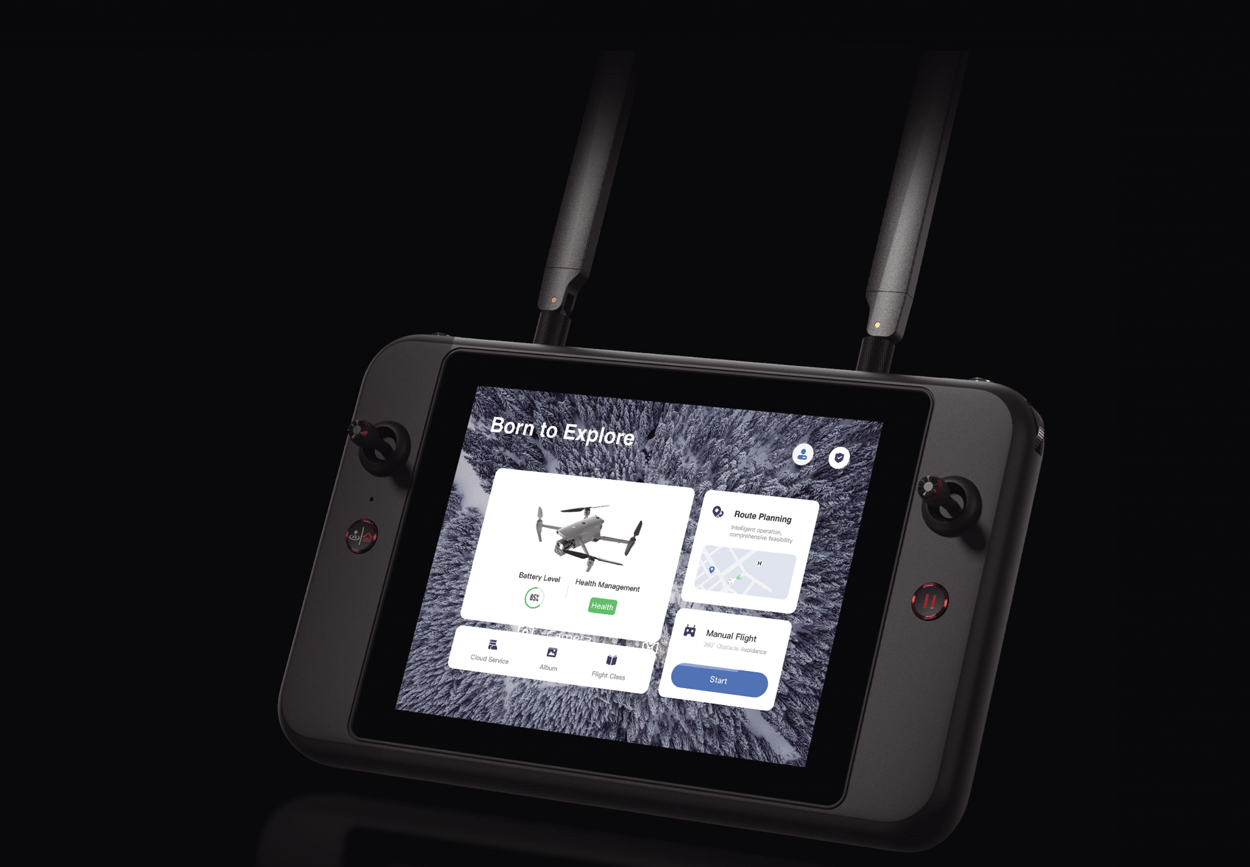
Smart Features
The EVO Max 4N comes equipped with the following intelligent features that were tailored for commercial end users:
3D Map Planning
Plan, create, and execute 3D waypoint mission plans on a 3D map.
Mission Reproduction*
Fly a manual or semi-autonomous mission, or string multiple missions together. The EVO Max 4N will automatically record the camera angles and replicate the mission you just flew.
Quick Mission*
Temporary quick missions can be created while executing other missions, and multiple sub-missions can be stacked for enhanced flexibility.
Multiple Mission Types
The Enterprise App provides various autonomous and semi autonomous mission planning for public safety, inspection, and surveying.
 Waypoint Missions
Users can add waypoints for flexible, non-structured flight paths.
Rectangular Mission
Supports one-click automatic generation of a rectangular flight area.
Automatic Mission (Generation And Data Capture*)
Automatically produce routes by adding regional boundary points through dots or importing KML files.
 Terrain Follow*
Maintain relatively constant altitude from the ground for uneven or sloped terrain.
Oblique Photography
Automatically plan 5 groups of routes (1 ortho + 4 oblique) according to the flight area set by the user.
Spiral Mission*
Supports helical flight search in a designated area for SAR.
 Polygon Mission
Supports one-click automatic generation of polygon flight areas.
Vertical Scan*
Perform vertical surveys for building facades, open pit walls, and towers.
Corridor Mission*
Supports intuitive and effective corridor mission planning for roads, rivers, pipelines, power lines and other narrow, large-scale terrain.
*This feature will be available in a future update.
Data Security
Featuring AES 128/256 storage, radio link and network encryption for operational security.
Privacy Protection: Data involving user and aircraft information, including flight logs, locations, and account information can only be physically accessed via the aircraft locally.
Encrypted Data Storage: Supports AES-256 encryption for photos, videos, and flight logs, are password-protected.

Enhanced Live-View
Multi-channel Projection Screen*
Supports simultaneous output of RGB, infrared, night vision, and wide-angle images.
*This feature will be available in a future update.
Complete Remote Operations System
Used with the EVO Nest, the EVO Max series supports all-weather auto piloting for scenarios such as substations, industrial parks, and rooftops.
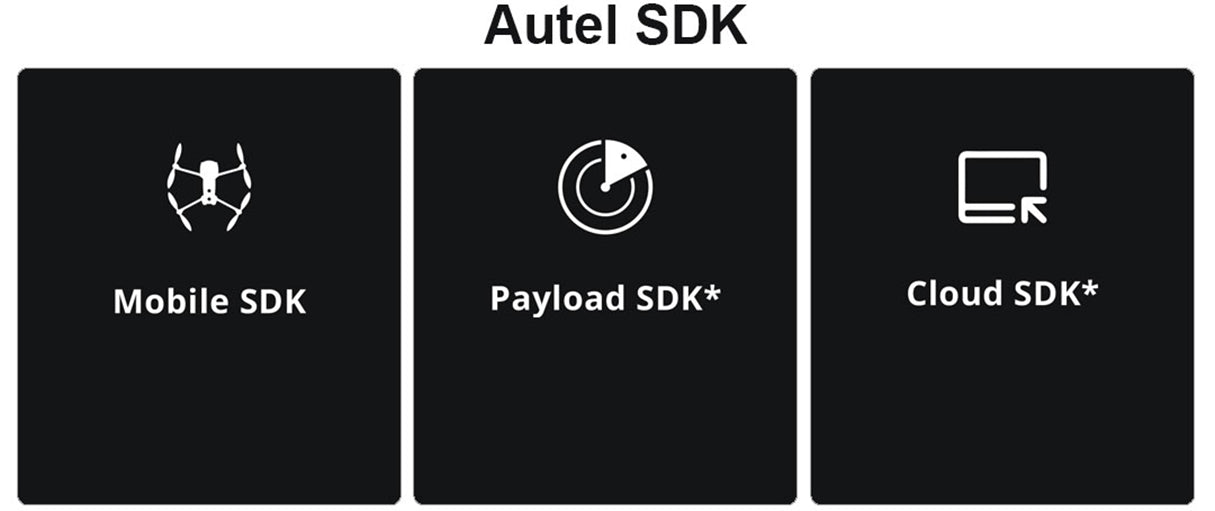
Autel SDK
The Autel SDK is open to the world, helping developers and partners reduce software and hardware development costs and jointly create a new industry ecosystem.
Mobile SDK
Open UX SDK (iOS & Android) can directly call up the ready-made interactive interface.
Payload SDK*
Unified interface standards support access to third-party mounts such as microphones and gas detectors.
Cloud SDK*
Enables remote live broadcast and control of drones and Nests through third-party platforms or web pages.
Application
The Autel EVO Max 4N was designed for survey and inspections, search and rescue operations, public safety, and many other commercial applications.


![Autel Robotics EVO II Pro V3 Camera Drone[Orange]](https://i0.wp.com/www.neolinktrading.com/wp-content/uploads/2025/07/AutelRoboticsEVOIIProV3_4_4bca7f08-f50c-412c-8322-625f90fbec29_622x622.webp?fit=622%2C622&ssl=1)


Premium Support –
Access Premium Customer Support Portal